Wednesday, July 31, 2013
Tuesday, July 23, 2013
Could Tea Grow In The USA?

If one decides to drink a cup of tea, there is one thing to consider: Where the tea came from. Most of the tea that one drinks will most likely come from Asia, mainly India, China, or Japan. Having thought of this, it brings up an important question: Could tea grow in the USA?
Why ask this question? Well, it could be an important jump start to the economy to grow tea on a large scale in the USA. If grown in the USA, there would be a ready market for this tea, as many Americans and Canadians drink tea. The question is, however, could it be done?
Well, to figure this out, one must consider the climate types in which tea will be the most successful on a commercial scale. Although in theory, tea can be grown in marine climates, such as Washington State and in southern England, they aren't tea producing regions by any stretch. This is a plant that grows mainly in tropical and subtropical climates. At least 50 inches of rain per year are required for this plant, and it grows best in acidic soil. Basically, due to climate, this cuts out most of the USA. Most of the USA would be too cold or too dry for this plant to thrive.
This would basically leave the Southeast USA as a potential place to grow tea. In fact, there is tea being grown near Charleson,SC. The Charleston Tea Plantation is America's largest tea garden,which is found on Wadmalaw Island. It's also the first place in America to grow tea.


Charleston Tea Plantation
With tea being able to grow near Charleston,SC, there are other places, such as near Savannah,GA, and along the Gulf Coast region from Florida to Texas. There would be the potential to grow tea in the Deep South, mainly South Carolina, Georgia, Florida, Alabama, Mississippi and Louisiana. Texas would also have tea growing potential. The climate is good for grown tea. Tea grows best in USDA zones 7-9.

So really, it is a question of why MORE tea isn't being grown in the USA. If not climate, then could it be cost of production? Demand? Who knows. It leaves alot to think about.
Sources:
http://www.rodale.com/grow-your-own-tea
Tuesday, July 16, 2013
Minneapolis: City of Water.

Water has been an important factor in how many cities have formed. The city of Minneapolis is one particular case to analyze. One must look at historical geography to understand how physical geography has had an impact on economic geography.
The city of Minneapolis was built in 1856 as a town. Fort Snelling nearby had attracted people before. The city was incorporated in 1867. What made Minneapolis grow was its water resources. Industry grew around St. Anthony Falls, the highest waterfall along the Mississippi river.


This waterfall provided a very important source of hydropower. With plenty of timber in Minnesota, sawmills operated from water power. With railroad service, grain and other goods would be shipped into Minneapolis. Flour mills would flourish in Minneapolis. One flour mill made enough flour to make 12 million loaves of bread per day. Companies like Pillsbury and General Mills would form. Minneapolis would get a nickname from this, "the mill city".
Water played a very important part in Minneapolis' history. It was with water that hydropower was used to power the mills, and helped Minneapolis grow.
Minneapolis is also home to 6 lakes. It has developed the nickname "city of lakes" for this very reason. The cities lakes are very important sources of recreation for many residents. Activities such as fishing, swimming, ice skating, and boating are among the forms of recreation that residents can do at these lakes.These lakes formed as a result of glaciers melting and retreating. The melting and retreating of glaciers left behind lakes in Minneapolis, as well as the rest of Minnesota. It also carved out how the Mississippi river would flow through the rocks and soil. Minneapolis' name comes from the Dakota work "mni" and the Greek word "polis", literally translating to Water City.
Minneapolis can be thought of as the Water City. Water has played an important role for the Twin Cities. This aspect of physical geography has historically been important to the economy, and helped the city grow.
Sources: http://www1.umn.edu/marp/dig/site3.html
http://www.fromsitetostory.org/tcm/tcmintro.asp
http://www.fromsitetostory.org/sources/papers/mnarch49/49a-concl.asp
Thursday, July 11, 2013
Murmansk, the Great Arctic Port
Try to imagine a port city above the Arctic Circle. For some people, such is possible. For others, there is an err of distrust towards such an idea. Well, this is a possibility. In fact, this is the case.
Now try to imagine an Arctic port for which the waters off of the coast remain ice-free all year long, even on the coldest of winter nights. Some people will find this even more impossible. One often cannot imagine the Arctic without imagining the water freezing over.
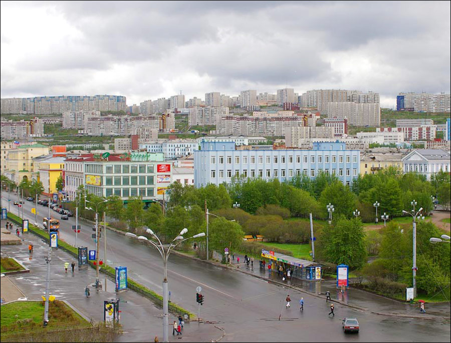
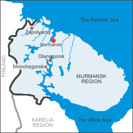
Actually, this is already happening. And that city of Murmansk, Russia. Murmansk is a the largest port city north of the Arctic Circle, as well as being the largest city north of the Arctic Circle. It's location is in the Murmansk Oblast, 12 km from the Barents Sea, inside of a fjord.
And despite being so far north, it remains an ice free port. Murmansk is also the last city to be founded before the collapse of the Russian Empire. It was founded in 1916. It was World War One. Russia needed an ice-free location to have supplies shipped. A railroad was built up to the Murman Peninsula because it was an ice-free location. It's original name was Romanov on the Murman.
How is it that Murmansk, which is so far north, can remain ice free? Well, it has alot to do with ocean currents. It starts with the Gulf Stream. This warm ocean current flows north all the way to Norway and reaches Murmansk. This warm current keeps the waters at Murmansk ice free in the winter. The current works like a conveyor belt, carrying relatively warm water to an otherwise cold location.
Map explaining how Murmansk is ice free.

Murmansk is important because of its location along ice free waters. It is home to a large icebreaker fleet. There is a Russian Navy base in its satellite city, Severomorsk, and 41% of marine transportation comes from this region. This has made Murmansk an important Russian port.

http://englishrussia.com/2011/02/15/severe-arctic-murmansk/
Friday, July 5, 2013
Lake Issyk-Kul: The Hot Lake


Located in the eastern portion of the nation of Kyrgyzstan, Lake Issyk-Kul is a lake of wonders. For starters, its size. As far as lakes at large are concerned, this is the 10th largest lake in the world by volume. If one were to count only alpine lakes, this is the second largest alpine lake in the world(Lake Titacaca is the largest alpine lake in the world). Lake Issyk-Kul has a slight saline content as well.
Another thing to consider about the lake is this. This lake NEVER freezes, except for only the most shallow areas of the lake, such as the coves. Lake Issyk-Kul is located in the high altitudes, at 1607 m above sea level. It is also ringed by the Tian Shan Mountains, which are capped with snow. In fact, Issyk-Kul's name is Kyrgyz for "hot lake".
Why does Lake Issyk-Kul never freeze? Well, one reason to consider is this. Even thought Lake Issyk-Kul has a slight saline content, but only a slight saline content. Salt in water will lower the freezing point of water. However, the salinity of Lake Issyk-Kul is 0.3%, so the effect of salt water might play a part, but not as much as it would for an ocean, which would have a higher salt content.There is another reason that has been looked at. There are warm springs at the bottom of the lake. Because of these warm springs, this lake never freezes. so even on the coldest winter day in this portion of Kyrgyzstan, the lake stays liquid.
Lake Issyk, a lake of wonders.
Image source: http://www.steppejourneys.com/p/combined-country-tours.html
Other sources: http://www.globalnature.org/24451/LIVING-LAKES/Asia/Issyk-Kul/02_vorlage.asp
http://www.issykkulinvest.kg/en/why-issykkul-oblast/tourism/Recreation-zones/Issyk-Kul-Biosphere-Area/
http://www.happytellus.com/lake-issyk-kul/kyrgyzstan
http://aslo.org/lo/toc/vol_47/issue_4/1210.pdf
Thursday, July 4, 2013
Detroit: More Than Cars, part II. The Detroit River
Click to this link: http://pangeographic.blogspot.com/2012/11/detroit-more-than-cars.html
If one takes a look on that post, one will understand the purpose of this post
In the last post, there were many things about Detroit that were mentioned, how Detroit is more than just automobiles, on how geography has been significant for Detroit. This is part II of this.
In part one, it was mentioned that Detroit was a major shipping center. Well, there will be a bit more on this subject. This will be about the Detroit river.
The Detroit river has played an important role for Detroit. It was lightly touched on that is was a major shipping center. However, this is the extent to which it was a major shipping center. The Detroit river, in 1908, was the busiest commercial river. Over 67 million tons of shipping commerce went through the Detroit river at this time. This is more than three times what New York City had at that time period. This is much more tonnage than London had at the time. The waters of the Detroit river were very busy, and it did play a part in Detroit growing It was important to industry. Detroit Dry Dock's engine works was a major shipbuilder during its time.

The Detroit river was also important for the fur trade. Having a centralized location, and being in the middle of a region rich in fur resources at the time, it made perfect sense to build Fort Pontchartrain de Détroit along the Detroit river. Ample water resources for travel, and a strategic location helped Detroit in the fur trade.
On another note, there is something else about the Detroit river. It is home to the Detroit River International Wildlife Refuge. It is the only wildlife refuge in the world that is in two different nations.

Detroit in more than just the Motor City. It is a city whose growth and history have been linked to its waterways. It is a city that has a deep history. If one looks past it's history as a city of automobile, one can see it has been many things to many different people. The historical and geographic roles of Detroit have been significant. The Detroit river has played a big role for this city. However, it is such a history that isn't always been recognized.
Image Sources: maritimehistoryofthegreatlakes.ca
Easth Observatory
Information:
Triumph of the City: How Our Greatest Invention Makes Us Richer, Smarter by Richard Glaeser.
Tuesday, July 2, 2013
The Trans-Siberian railroad;A massive geographic feat.

From the European plain of Russia to the Pacific coast, crossing many time zones, going across 17 rivers, traveling through 2 continents, and many different land forms. That is only a small part of what the Trans-Siberian Railroad is.
The line starts in Moscow, and ends at Vladivostok, in Russia's far east. There is the Trans-Mongolian Railway and the Trans-Manchurian Line. You start from Moscow, but rather than go all the way to Vladivostok, you stop at Ulan Ude and follow the railroad to Beijing via Mongolia. This is the Trans-Mongolian Railway. To travel the Trans-Manchurian Railway, one stops at Chita, and takes that railroad spur to Beijing via the Jilin province of China(formerly known as Manchuria).

In many ways, the Trans-Siberian Railroad is a major geographic feat. The distance of this railroad is quite telling. It is the world's longest railway line.There is literally no other railway line to cross TWO(2) continents. It is one reason it is such a geographic feat. However, this is not the biggest reason why.
In order to get the whole idea of this railroad, one has to know the work that it took to get this railroad built.
Millions of people moved to Siberia from the western portion of Russia. between the 19th and early 20th century. Many were settlers. Many were also prisoners exiled there. For a long time, Siberia had issues with transportation. Before the building of the railroad, rivers served as the main transportation source, when the rivers were not frozen. When the rivers froze over, the rivers were used for transporting goods via carriage or any other form of transportation not involving water. The Great Siberian Route was a major road of transportation.
Previous railway projects for Siberia had been proposed before, but were basically ignored. It was thought to be impossible to build a railway across all of Russia, all the way to the far eastern reaches of Siberia. However, in 1890, the building of the Trans-Siberian Railroad would commence in 1891.It was constructed between 1891 and 1916. Like the American railroad, the Trans-Siberian started building at two different ends. One part started in western Russia, and the other part started in the far eastern part of Russia, around Vladivostok.
Building across long distances was going to be hard enough. However, there were many geographical challenges along the way. Permafrost was one major factor. Digging through permafrost in the 1890s would have been a very difficult task, going through frozen soil. When the soil thaws, its muddy and not stable. There were also strong rivers, many lakes, and swamps. Mountains had to be crossed as well. The Siberian winters are quite harsh as well. Animals were a factor as well. With bears and tigers around, there was an added danger of being killed via being attacked. Building around Lake Baikal was difficult. Because of the lack of flat coastline, tunnels had to be built out of the hills or platforms had to be made.
Another thing to consider was the onset of the Russo-Japanese War during the early 1900s. With Japan across the water from Russia(on the Pacific side), there was a rush to connect both the western and eastern spurs to get soldiers and weapons to Japan via Vladivostok.
The railway line is also of importance economically. It is a major supply line for Siberia's large cities and populated areas in Siberia. It has helped the development of industry and agriculture in Siberia, and cities along the line have developed, such as Krasnoyarsk, Khabarovsk, Vladivostok, Omsk, and other Siberian cities. Siberia's population has grown along the rail line. The rail line has helped in transporting resources such as coal, timber, and iron.
The Trans-Siberian Railroad is a major geographic feat because of the distances spanned, the economic benefits it provided, and furthermore, the battle of many geographic challenges, such as the weather, and geological problems. This railway was built against all odds, and still runs today.

Vladivostok Station.
Sources:
http://www.coolfamily.com/Siberia.htm
http://books.google.com/books?id=mDJjgJWT34AC&pg=PA60&lpg=PA60&dq=trans+siberian+railway;swamps;mountains,permafrost&source=bl&ots=sM5Adc6BWH&sig=9-fU4ztIzwOA8LK7YjVg8xaI7Jk&hl=en&sa=X&ei=9E3TUeneO4OQ9gT5h4DYDA&ved=0CFEQ6AEwBA#v=onepage&q=trans%20siberian%20railway%3Bswamps%3Bmountains%2Cpermafrost&f=false
http://www.irkutsk.org/fed/transsib.html
http://www.frontiersoftravel.com/journey_summary.php?name=Trans-Siberian_Railway
http://rbth.ru/articles/2010/12/08/transsiberian_to_expand_as_russia_turns_east05189.html
http://www.russianlessons.net/articles/transsiberianrailway.php?lang=english
http://torussia.org/trans-siberian_railway
http://www.hyperhistory.net/apwh/essays/comp/cw24transrailroads32101525.htm
http://www.telegraph.co.uk/travel/journeysbyrail/9666654/Trans-Siberian-Great-Train-Journeys.html
Monday, July 1, 2013
Northernmost tea plantation in the world
When one thinks about where tea is grown, many people would think of places such as India, China, Japan, basically, places in southern and eastern Asia. If you think of the same thing, you would be right. These are the places where tea production is among the highest. The climate and soil types are right for growing tea.
However, there is one place no one ever thinks of when it comes to growing tea. And this is the place I want to discuss. It is the Dagomys Tea Plantation, located near Sochi,Russia.

Many might be thinking "Russia growing tea"? Actually, a small portion of the nation has some tea growing. This is located around the Sochi area. This is the northernmost point in the world where tea is grown, at 43 degrees North latitude. Now, at this latitude, there are many places where tea growing is not suitable because of very cold winters. However, Sochi does not fit this rule. An explanation in the next paragraph.
This is Sochi's location.


The region where tea can be grown, is in the southernmost portion of Russia, and on the Black Sea coast. This influences the climate. The very cold winters found in the rest of Russia are not to be found along this part of Russia. Being a coastal city with the Caucasus Mountains behind it, the sea moderates the temperatures and blocks out the cold winds from further north. This portion of Russia has a subtropical climate, which is conducive for growing tea.
So, there you have it, the northernmost location in the world where tea is grown, the Black Sea coast of Russia, around the Sochi area.
Sources:
http://www.virtualtourist.com/travel/Europe/Russia/Krasnodarskiy_Kray/Dagomys-638353/Things_To_Do-Dagomys-TG-C-1.html
http://ussa.org/foundation/about-sochi
Subscribe to:
Comments (Atom)