Photo from Reuters.
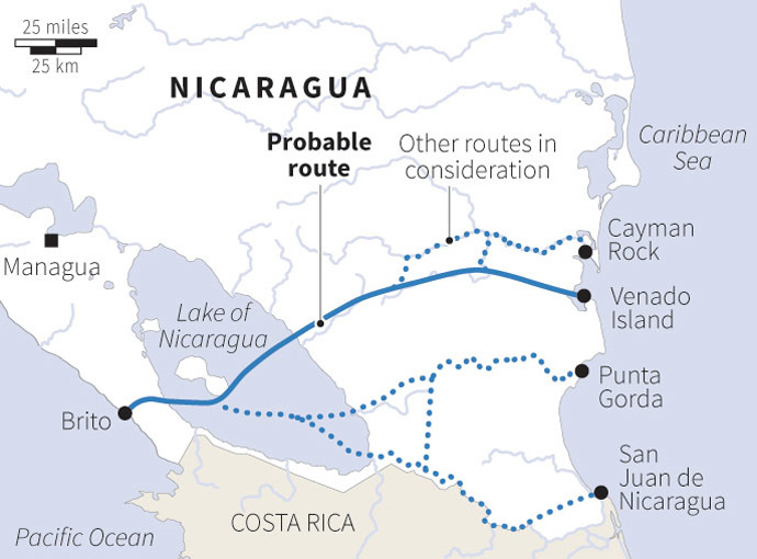
If one looks at this map, there is one main route being proposed. However, if you look at the dotted line, those are alternative routes being considered. One the Pacific side, it starts at Brito. The route will go through Lake Nicaragua. In geological terms, this would make sense, as this is the shortest route, the easiest route, and it connects to water. The main route cuts through rivers. One other route being considered also goes through rivers. The idea is that this canal will basically connect bodies of water, making it relatively easy to construct.
This canal is expected to rival the Panama Canal. The Panama Canal is considered a very great engineering feat. What is ironic is that if this canal in Nicaragua is completely by 2020 as expected, it will be over 3 times longer. The Panama Canal was only 77 kilometres long. It was chosen because of it was the narrowest point on the continent.
One question is this. Would building a canal across Nicaragua shorten maritime journeys in the same way the Panama Canal did? That is something very important to consider. Will it complement the Panama Canal? Or will journeys be a bit longer? Important questions to ask, considering the reason for building the Panama Canal.
No comments:
Post a Comment